From the birth of the first permanent photograph in 1826 to today’s advanced digital imaging systems, photography’s evolution stands as one of humanity’s most transformative technological journeys. This remarkable timeline spans nearly two centuries, fundamentally changing how we capture, preserve, and interpret reality through the lens of innovation.
The story of photography’s evolution isn’t just about technical advancement—it’s a testament to human ingenuity and our relentless pursuit of visual storytelling. From Nicéphore Niépce’s grainy heliograph to the instantaneous, high-resolution captures of modern smartphones, each breakthrough has democratized image-making and expanded creative possibilities.
As we trace this fascinating progression, we’ll explore how each era brought revolutionary changes: the introduction of portable cameras in the 1880s that freed photographers from studio constraints, the game-changing arrival of color photography in the 1930s, the digital revolution of the 1990s, and the AI-powered computational photography of today. These innovations haven’t just changed how we take pictures—they’ve fundamentally altered how we see and document our world.
Join us on this visual journey through time, where art meets science, and where each technological leap forward has brought us closer to perfectly capturing life’s precious moments.
Early Urban Documentary Photography (1839-1900)
Daguerreotypes and City Portraits
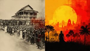
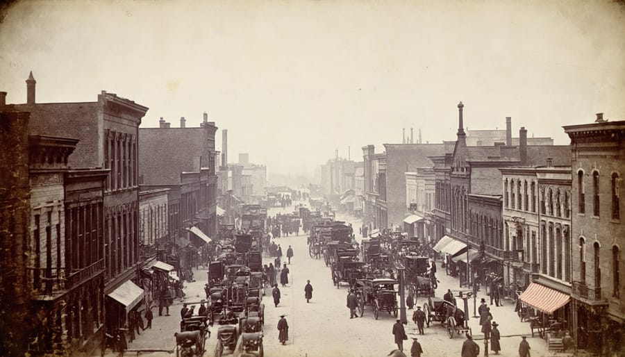
The first successful urban photographs emerged in the form of daguerreotypes in the late 1830s, marking a revolutionary moment in both photography and urban documentation. Louis Daguerre’s 1838 image “Boulevard du Temple” in Paris stands as one of the earliest surviving photographs of a city scene, capturing the busy street with an eerily empty appearance due to the long exposure time required – sometimes up to 30 minutes.
These early urban photographs faced significant technical limitations. The daguerreotype process required subjects to remain completely still, making it nearly impossible to capture the true hustle and bustle of city life. Only stationary subjects like buildings, streets, and the occasional person who stayed motionless long enough would appear in these images. Despite these constraints, photographers persevered, documenting the rapid urbanization of major cities like Paris, London, and New York.
By the 1840s and 1850s, improvements in the daguerreotype process allowed for slightly faster exposure times, though still requiring several minutes of stillness. This technological advancement enabled photographers to capture more detailed cityscapes, architectural features, and even some early street scenes. These images now serve as invaluable historical documents, offering unique glimpses into the urban landscape of the Victorian era and the dramatic changes brought about by the Industrial Revolution.
Social Documentation Movement
In the late 19th century, photographers began turning their lenses toward the harsh realities of urban life, sparking what would become known as the Social Documentation Movement. This pivotal shift in photography’s purpose transformed the medium from purely artistic expression to a powerful tool for social change and documenting cultural heritage.
Pioneers like Jacob Riis and Lewis Hine wielded their cameras to expose the dire living conditions in American cities. Riis’s groundbreaking work “How the Other Half Lives” (1890) shed light on New York’s tenement districts, using revolutionary flash photography techniques to capture dimly lit indoor scenes. His stark images of overcrowded apartments and child laborers shocked the public conscience and catalyzed housing reforms.
Similarly, Lewis Hine’s photographs of child workers in factories and mines became instrumental in changing labor laws. His systematic approach to documentation, combining detailed notes with carefully composed images, set new standards for photojournalism. These early social documentarians developed techniques we still use today, such as environmental portraiture and candid street photography.
Their work not only advanced photographic practices but also demonstrated how images could drive social progress, establishing photography as a vital tool for urban reform and historical record-keeping.
The Modern City Through the Lens (1900-1950)
The Rise of Street Photography
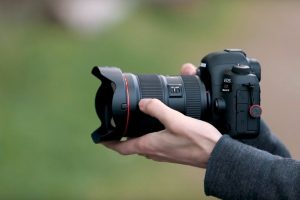
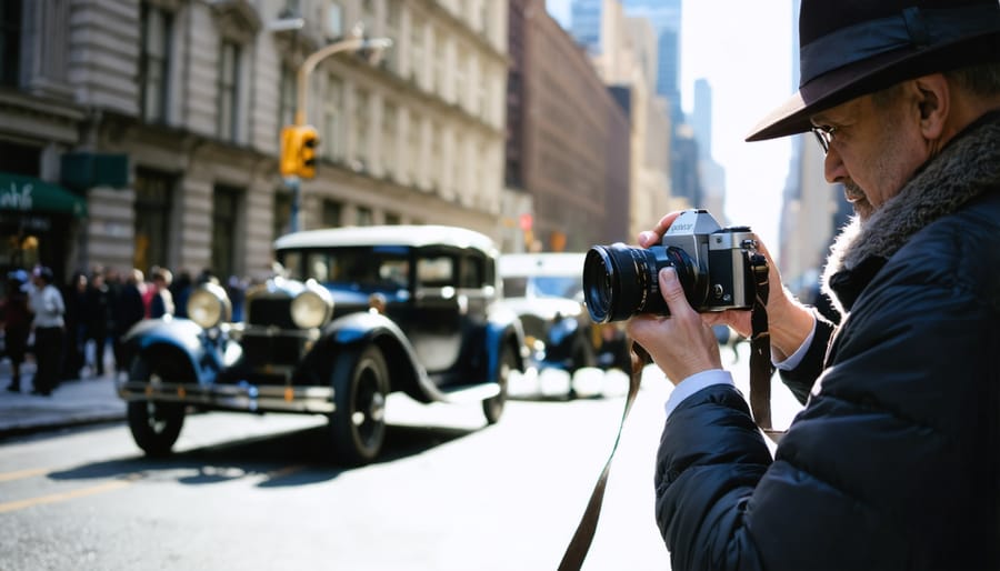
Street photography emerged as a revolutionary movement in the early 20th century, fundamentally changing how we document urban life. The introduction of more compact cameras, particularly the Leica I in 1925, freed photographers from the constraints of bulky equipment and studio setups, allowing them to move swiftly through city streets while capturing powerful urban narratives with unprecedented spontaneity.
The development of faster films and more sensitive emulsions enabled photographers to shoot in varying light conditions, making it possible to capture authentic moments without artificial lighting. Pioneers like Henri Cartier-Bresson, Vivian Maier, and Robert Frank transformed urban documentation by emphasizing candid moments and genuine human expression over posed portraits.
This new approach to photography coincided with rapid urbanization, creating a perfect storm for visual storytelling. The streets became living galleries, with photographers documenting everything from mundane daily activities to significant social movements. The rise of 35mm cameras made photography more accessible to enthusiasts, leading to a democratization of the medium.
Technical innovations like zone focusing and the rangefinder system allowed photographers to capture fleeting moments with greater precision. The ability to pre-focus and shoot quickly became essential skills for street photographers, who often had mere seconds to compose and capture their shots.
By the 1950s, street photography had evolved into a distinct artistic movement, influencing photojournalism, documentary photography, and fine art. Magazines like Life and Look regularly featured street photographs, bringing urban narratives to millions of homes and establishing photography as a powerful medium for social commentary.
This era marked a significant shift in how we perceive and document urban life, establishing techniques and approaches that continue to influence modern photographers. The legacy of street photography’s golden age lives on in contemporary digital practice, where smartphones and mirrorless cameras have made spontaneous urban documentation more accessible than ever.
Architectural Photography’s Golden Age
The 1920s through the 1960s marked an extraordinary period for architectural photography, coinciding with the dramatic rise of modern cityscapes. As skyscrapers began piercing the clouds in major metropolitan areas, photographers found themselves with unprecedented creative opportunities and technical challenges.
Pioneers like Berenice Abbott revolutionized the field with her “Changing New York” project, capturing the city’s transformation during the 1930s. Her innovative techniques for photographing tall buildings, including extreme angles and precise timing for optimal lighting, set new standards for preserving architectural heritage through photography.
The emergence of more sophisticated cameras and wide-angle lenses enabled photographers to capture entire buildings in a single frame, while maintaining perspective control. The legendary Julius Shulman popularized architectural photography through his iconic images of modernist buildings, particularly in Los Angeles. His masterful use of composition and natural light transformed architectural photography from mere documentation into an art form.
During this golden age, photographers didn’t just document buildings; they told stories about urbanization, social progress, and technological advancement. Ezra Stoller’s work, for instance, captured the optimism of post-war America through his pristine images of corporate headquarters and institutional buildings.
The period also saw significant technical innovations. The introduction of better film emulsions allowed for more detailed shadows and highlights, crucial for capturing the interplay of light and shadow on modern glass and steel structures. View cameras with tilting and shifting capabilities became essential tools, enabling photographers to correct perspective distortion and maintain parallel vertical lines – a crucial aspect of architectural photography.
This era’s legacy continues to influence how we photograph architecture today, establishing fundamental principles that remain relevant even in our digital age. The techniques developed during this period laid the groundwork for modern architectural photography, blending technical precision with artistic vision.
Digital Revolution and Urban Documentation (1950-Present)
Aerial and Satellite Photography
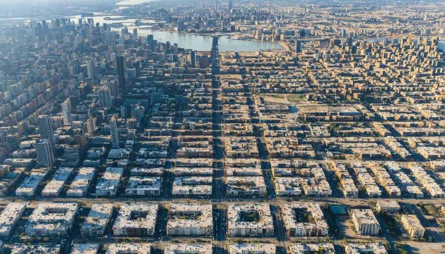
The advent of aerial and satellite photography in the mid-20th century revolutionized our understanding of urban landscapes and fundamentally changed how we approach city planning. Beginning with early aerial photographs taken from hot air balloons in the 1940s, this technological advancement provided urban planners and architects with unprecedented views of city layouts, growth patterns, and spatial relationships.
The 1960s marked a significant turning point with the launch of the first satellite imaging systems. NASA’s early Earth observation satellites captured broad-scale images that revealed urban sprawl patterns and environmental changes in ways previously impossible to document. These images became invaluable tools for monitoring urban expansion, tracking land-use changes, and understanding the environmental impact of city development.
By the 1970s and 1980s, aerial photography had become an essential component of urban planning. High-resolution aerial images helped planners identify traffic patterns, assess infrastructure needs, and make informed decisions about future development. The technology proved particularly valuable in rapidly growing cities, where traditional ground-based surveying methods struggled to keep pace with expansion.
The digital revolution of the 1990s brought new capabilities to aerial and satellite photography. Digital sensors and advanced image processing techniques improved image quality and enabled real-time monitoring of urban changes. Geographic Information Systems (GIS) integration allowed planners to overlay multiple data layers, creating comprehensive urban analysis tools.
Today, drone photography has added another dimension to urban documentation, offering highly detailed images of specific areas at a fraction of the cost of traditional aerial photography. Combined with advanced satellite technology, these tools provide unprecedented insights into urban heat islands, traffic flow patterns, and green space distribution, helping cities develop more sustainable and livable environments.
The evolution of aerial and satellite photography continues to shape our understanding of urban spaces, providing essential data for smart city initiatives and sustainable urban development strategies. This technology has become indispensable for modern urban planning, environmental monitoring, and architectural design.
Social Media and Urban Photography
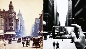
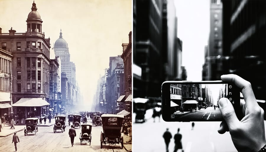
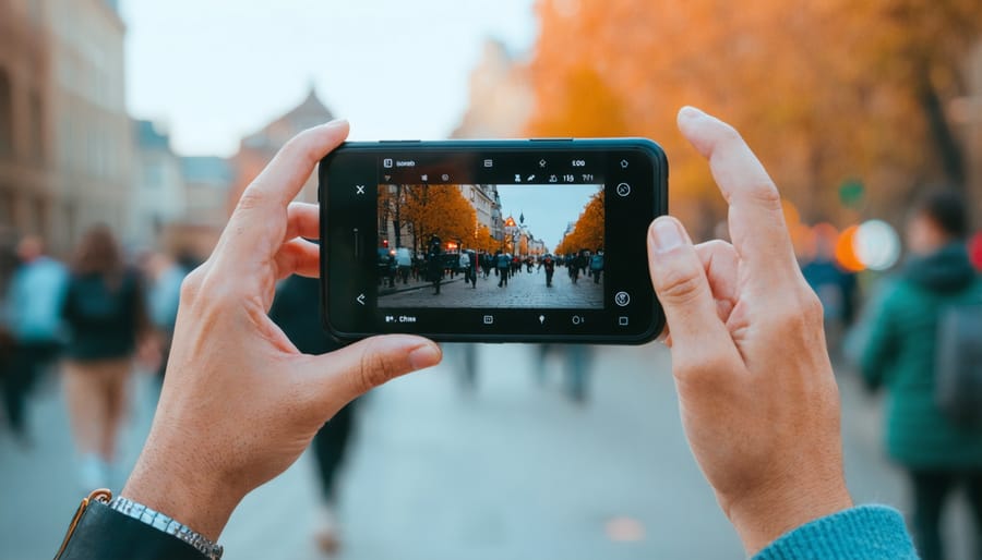
The rise of smartphones and social media platforms has fundamentally transformed how we document and share urban landscapes. What was once the domain of professional photographers with expensive equipment has become accessible to anyone with a mobile device, leading to an unprecedented democratization of urban photography.
Instagram, launched in 2010, played a pivotal role in this transformation by introducing filters and editing tools that made artistic urban photography accessible to the masses. The platform’s square format initially challenged photographers to rethink composition, while hashtags created communities around urban exploration and street photography.
Smartphones have evolved to feature sophisticated camera systems, with some models offering capabilities that rival professional equipment. Features like HDR, night mode, and computational photography have made it possible to capture stunning cityscapes in challenging lighting conditions. This technological advancement has sparked new movements in urban documentation, with photographers reclaiming urban narratives through their unique perspectives.
The impact extends beyond mere documentation. Social media platforms have created virtual galleries where amateur and professional photographers alike share their vision of urban spaces, fostering dialogue about city development, gentrification, and cultural preservation. Photo-sharing communities have emerged around specific architectural styles, street art, and urban decay, creating rich visual archives of cities in transition.
This democratization has also influenced how we perceive and interact with urban spaces. Popular photo spots become tourist destinations, while lesser-known locations gain visibility through viral shares. The phenomenon has even affected urban planning, with some developers now considering “Instagram-worthy” features in their designs.
The constant evolution of mobile photography technology continues to push boundaries, with AI-enhanced capabilities and augmented reality features offering new ways to capture and interpret urban environments. This democratization has not only changed how we document cities but has also transformed the very nature of urban photography itself.
Time-Lapse and Long-Term Projects
Time-lapse photography has revolutionized how we document urban transformation, offering a powerful way to compress years of development into minutes of compelling footage. Since the early 2000s, photographers have increasingly embraced long-term documentation projects, using advanced camera systems and automated setups to capture cities’ evolving skylines and neighborhoods.
Modern time-lapse projects often employ weatherproof camera housings equipped with solar panels and cellular connectivity, allowing for continuous shooting over months or even years. These systems can be programmed to capture images at specific intervals, adapting to changing light conditions and automatically uploading footage to cloud storage for real-time monitoring.
Notable examples include the documentation of the One World Trade Center construction, where multiple cameras captured the building’s rise from 2004 to 2013. Similarly, photographers worldwide have chronicled major infrastructure projects, from bridge constructions to entire city district developments, creating valuable visual records of urban evolution.
Digital asset management has become crucial for these projects, with photographers developing sophisticated workflows to handle hundreds of thousands of images. Modern software allows for automated image alignment, exposure matching, and deflickering, resulting in smooth, professional-quality time-lapse sequences.
The emergence of construction cameras has added another dimension to long-term documentation. These specialized systems combine time-lapse capabilities with project management tools, allowing stakeholders to monitor progress remotely while creating historical records of development.
Social media has also influenced how these projects are shared, with photographers releasing progress updates through platforms like Instagram and YouTube. This immediate sharing capability has made long-term photography projects more engaging for public audiences, fostering greater awareness of urban development processes.
Looking ahead, emerging technologies like AI-powered camera systems and drone integration are expanding the possibilities for long-term documentation, enabling more comprehensive and dynamic coverage of urban transformation projects.
Photography’s Role in Urban Planning Today
In today’s urban landscapes, photography plays an increasingly vital role in shaping how cities evolve and develop. Modern urban planners rely heavily on photographic documentation, combining traditional photography with cutting-edge technological innovations to make informed decisions about city development.
Aerial photography and drone imagery have revolutionized the way urban planners visualize and analyze cityscapes. These tools provide comprehensive views of traffic patterns, land use, and urban sprawl, enabling better-informed decisions about infrastructure development. Time-lapse photography has become particularly valuable, allowing planners to track construction progress and study how communities interact with public spaces over time.
Social media and citizen photography have also emerged as powerful tools in urban planning. Through visual storytelling techniques, residents document their daily experiences, highlighting issues like accessibility challenges, traffic congestion, or underutilized spaces. This bottom-up approach provides planners with invaluable insights into how people actually use and experience their cities.
Looking ahead, emerging technologies like augmented reality (AR) photography and 3D photogrammetry are set to transform urban planning further. These tools allow planners to create detailed virtual models of proposed developments, helping stakeholders better understand the potential impact of new projects on existing communities.
The integration of AI-powered image analysis is also helping planners process vast amounts of photographic data more efficiently, identifying patterns and trends that might otherwise go unnoticed. This technological advancement enables more data-driven decision-making in urban development while maintaining the human-centric approach essential to successful city planning.
Photography’s role in documenting and influencing urban environments continues to evolve, becoming more crucial than ever in our rapidly changing cities. From the first cityscapes captured on daguerreotypes to today’s high-resolution aerial drone photography, the medium has consistently provided invaluable insights into urban development and transformation.
Modern photographers combine traditional techniques with cutting-edge technology to tell compelling stories about our cities. Through time-lapse photography, we can witness years of urban growth in minutes, while architectural photographers capture the intricate details of our built environment with unprecedented clarity. Social media and digital platforms have democratized urban photography, allowing citizens to participate in documenting their changing neighborhoods and contributing to a collective visual history.
Looking ahead, emerging technologies like augmented reality and AI-enhanced imaging promise to revolutionize how we capture and understand urban spaces. These advancements will not only help urban planners and architects make more informed decisions but also enable communities to better visualize and participate in shaping their future environments. As cities continue to grow and evolve, photography remains an essential tool for recording, analyzing, and imagining the future of urban life.